
- Home

- Rivers - Vermilion-Wabash Basin
- Search Results
Search Results
Search Results For:
River > Vermilion-Wabash Basin
37 links were found.
Jump to: Data Online Maps/GIS Publications Agencies/Organizations
Displaying Page 1 (of 2)
Data Online- 1 BIG FOUR DITCH ABOVE PAXTON, IL - Water Data
- The USGS National Water Information System provides real-time and historical data on surface water flow, ground water levels, and water quality of streams in the US.
- 2 BIG FOUR DITCH BELOW PAXTON, IL - Water Data
- The USGS National Water Information System provides real-time and historical data on surface water flow, ground water levels, and water quality of streams in the US.
- 3 BIG FOUR DITCH NEAR PERDUEVILLE, IL - Water Data
- The USGS National Water Information System provides real-time and historical data on surface water flow, ground water levels, and water quality of streams in the US.
- 4 Flood Discharge Database
- FEMA-published and selected other statistical flood discharge values, searchable by watershed or county.
- 5 Illinois Water Quality
- EPA maintained website with links to all Illinois watershed water quality summary reports dating back to 1996.
- 6 MIDDLE FORK VERMILION RIVER ABOVE CATLIN, IL - Water Data
- The USGS National Water Information System provides real-time and historical data on surface water flow, ground water levels, and water quality of streams in the US.
- 7 MIDDLE FORK VERMILION RIVER ABOVE OAKWOOD, IL - Water Data
- The USGS National Water Information System provides real-time and historical data on surface water flow, ground water levels, and water quality of streams in the US.
- 8 MIDDLE FORK VERMILION RIVER AT ARMSTRONG, IL - Water Data
- The USGS National Water Information System provides real-time and historical data on surface water flow, ground water levels, and water quality of streams in the US.
- 9 MIDDLE FORK VERMILION RIVER NEAR ARMSTRONG, IL - Water Data
- The USGS National Water Information System provides real-time and historical data on surface water flow, ground water levels, and water quality of streams in the US.
- 10 MIDDLE FORK VERMILION RIVER NEAR COLLISON, IL - Water Data
- The USGS National Water Information System provides real-time and historical data on surface water flow, ground water levels, and water quality of streams in the US.
- 11 MIDDLE FORK VERMILION RIVER NEAR GLENBURN, IL - Water Data
- The USGS National Water Information System provides real-time and historical data on surface water flow, ground water levels, and water quality of streams in the US.
- 12 MIDDLE FORK VERMILION RIVER NEAR JAMESBURG, IL - Water Data
- The USGS National Water Information System provides real-time and historical data on surface water flow, ground water levels, and water quality of streams in the US.
- 13 National Weather Service
- Provides weather, water, and climate data, forecasts and warnings.
- 14 Provisional Monthly Flow Data
- This site shows provisional, monthly mean flow data for 26 US Geological Survey gaging stations on rivers and streams throughout Illinois.
- 15 Rivergages.com: Water Levels of Rivers and Lakes
- US Army Corps of Engineers maintained interface to easily access water level data for all Illinois Waterway measurement stations in tabular, graphical, or downloadable form. Divided by watershed.
- 16 VERMILION RIVER NEAR CATLIN, IL - Water Data
- The USGS National Water Information System provides real-time and historical data on surface water flow, ground water levels, and water quality of streams in the US.
- 17 VERMILION RIVER NEAR DANVILLE, IL - Water Data
- The USGS National Water Information System provides real-time and historical data on surface water flow, ground water levels, and water quality of streams in the US.
- 18 VERMILION RIVER NEAR VERMILION HEIGHTS, IL - Water Data
- The USGS National Water Information System provides real-time and historical data on surface water flow, ground water levels, and water quality of streams in the US.
- 19 Vermilion River Stage Data and Forecasts
- Data provided by the National Weather Services Advanced Hydrologic Prediction Service
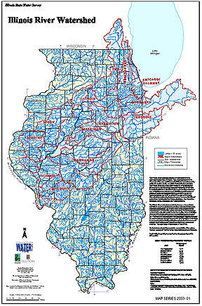
- 20 Illinois River Watershed - Poster
- Poster-sized (26x38) map of the entire Illinois River Watershed. Part of the Illinois State Water Survey published Map Series (2003-1)
- Download Options: LoRes preview | HiRes (3.5 MB) | Metadata
- Home
- | Data
- | Maps/GIS
- | Models
- | Publications
- | Research
- | Agencies
- | Visualizations
All files and information © 2018 Illinois State Water Survey. Disclaimer.
Email the Web Administrator with questions or comments.