
- Home

- Counties - Cumberland
- Search Results
Search Results
Search Results For:
County > Cumberland
42 links were found.
Jump to: Data Online Maps/GIS Publications Agencies/Organizations
Displaying Page 2 (of 3)
Page: [<< Prev] 1 | 2 | 3 | [Next >>]
Maps/GIS- 21 Illinois Floodplain Maps
- ISWS resource providing preliminary and final maps of Illinois floodplains.
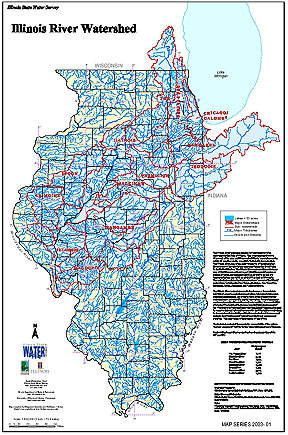
- 22 Illinois River Watershed - Poster
- Poster-sized (26x38) map of the entire Illinois River Watershed. Part of the Illinois State Water Survey published Map Series (2003-1)
- Download Options: LoRes preview | HiRes (3.5 MB) | Metadata
- 23 Major Watersheds of Illinois
- Poster-sized (26x38) map of the major watersheds in Illinois. Part of the Illinois State Water Survey published Map Series (2000-01)
- Download Options: LoRes preview | HiRes (730 K) | Metadata
- 24 Resource Management Mapping Service
- Interactive map that allows users to locate, create, and print maps of large and small areas within Illinois. Natural resource, administrative, and economic layers available.
 = Abstract available
  = Full Text available
  = Fact Sheet available
  = PDF format
  = HTML format
  = PowerPoint format
- 25 100 - year rainstorms in the Midwest: design characteristics


- Huff, Floyd A., 1993 ISWS C-176
- 26 7-day 10-year low flows of streams in the Kankakee, Sangamon, Embarras, Little Wabash, and southern regions
- Singh, Krishan P., Ganapathi S. Ramamurthy, and Il Won Seo, 1988 ISWS CR-441
- 27 Adequacy of Illinois surface water supply systems to meet future demands
- McConkey Broeren, Sally, and Krishan P. Singh, 1989 ISWS CR-477
- 28 Embarras River Watershed Digital Floodplain Mapping, Champaign County, Illinois
- McConkey, Sally A., Mark D. Johanson, 2002 ISWS CR 2002-05
- 29 Future water demands of public surface water supply systems in Illinois
- Singh, Krishan P., Sally McConkey Broeren, Robin B. King, and Michael L. Pubentz, 1988 ISWS CR-442
- 30 Hydraulic geometry of Illinois streams
- Stall, John B., and Yu-Si Fok, 1968 ISWS CR-92
- 31 Hydrology, Nutrient, and Sediment Monitoring for Hurricane and Kickapoo Creek Watersheds: Water Year 2000-2002: Pilot Watershed Program
- Keefer, Laura., 2006 ISWS CR 2006-03
- 32 Hydrometeorology of heavy rainstorms in selected Illinois basins
- Huff, Floyd A., 1981 ISWS RI-96
- 33 Identification of Unmapped Special Flood Hazard Areas in Illinois
- Graff, Philip, Chap, Laura, McConkey, Sally, DePue, Michael, Allan, Kingsley, Bicksler, Rebecca, 2008 ISWS CR 2008-05
- 34 Illinois Lake Quality Assessment Program - 1993
- Lin, Shun Dar, and Raman K. Raman, 1994 ISWS CR-574
- 35 Illinois Pilot Watershed Program

- Short summary of the pilot program in Illinois
- Dodd, Hope R., 2000 Illinois Natural History Survey Reports Summer 2000
- 36 Illinois Rivers Decision Support System
- Publication describing the motivation and initial planning for the ILRDSS.
- Demissie, Misganaw, Yiping Guo, H. Vernon Knapp, and Nani G. Bhowmik, 1999 ISWS Contract Report 648
- 37 Illinois Rivers Decision Support System (ILRDSS)
- Publication describing the progress and future plans of the ILRDSS.
- 2002 ISWS IEM 2002-02
- 38 Potential surface water reservoirs of south-central Illinois
- Dawes, Julius H., and Michael L. Terstriep, 1966 ISWS RI-54
- 39 Regional and sample skew values in flood-frequency analyses of streams in Illinois
- Singh, Krishan P., 1980 ISWS CR-227
- 40 Sediment and Water Quality Monitoring for the Hurricane and Kickapoo Creek Watersheds, Coles and Cumberland Counties, Illinois
- Keefer, Laura, 2004 ISWS CR 2004-05
- Home
- | Data
- | Maps/GIS
- | Models
- | Publications
- | Research
- | Agencies
- | Visualizations
All files and information © 2018 Illinois State Water Survey. Disclaimer.
Email the Web Administrator with questions or comments.