
- Home
 Watersheds
 - Watersheds - La Moine
Watersheds - La Moine
Watershed Profile
Name
La Moine
USGS Cataloging Unit
07130010
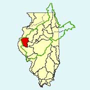
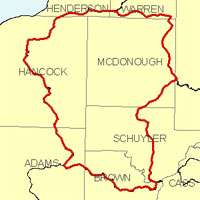
Description
The La Moine watershed in west-central Illinois is part of the Illinois River basin. With drainage from nine counties, the watershed has a total area of approximately 1,350 square miles. Agriculture is the primary use of land within the watershed.
Web Resources
- La Moine Watershed web links
- View all of the La Moine Watershed links in the ILRDSS database.
- The Illinois Streamflow Assessment Model (ILSAM)
- Stream flow estimates for streams located within the La Moine watershed.
Jump to another watershed
- Home
- | Data
- | Maps/GIS
- | Models
- | Publications
- | Research
- | Agencies
- | Visualizations
All files and information © 2018 Illinois State Water Survey. Disclaimer.
Email the Web Administrator with questions or comments.