
- Home

- Counties - Madison
- Search Results
Search Results
Search Results For:
County > Madison
73 links were found.
Jump to: Data Online Maps/GIS Publications Research and Programs Agencies/Organizations
Displaying Page 2 (of 4)
Page: [<< Prev] 1 | 2 | 3 | 4 | [Next >>]
Data Online- 21 Peruque-Piasa Watershed Water Data
- The USGS National Water Information System provides real-time and historical data on surface water flow, ground water levels, and water quality of streams in the US.
- 22 Shoal Watershed Profile
- Environmental Protection Agency website containing numerous links to environmental data about the Shoal watershed.
- 23 Shoal Watershed Resource Links
- USGS maintained site with links to data, projects, and publications on HUC watersheds.
- 24 Shoal Watershed Water Data
- The USGS National Water Information System provides real-time and historical data on surface water flow, ground water levels, and water quality of streams in the US.
- 25 1993 Mississippi River Flood Hazard Mitigation Grant Program
- 1993 Mississippi River flood maps that show properties damaged in the event.
- 26 Illinois County Boundaries, Polygons and Lines
- GIS data - zipped shapefile

- 27 Illinois Floodplain Maps
- ISWS resource providing preliminary and final maps of Illinois floodplains.
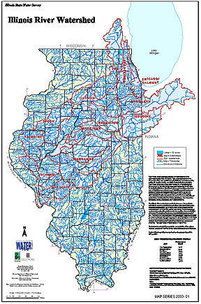
- 28 Illinois River Watershed - Poster
- Poster-sized (26x38) map of the entire Illinois River Watershed. Part of the Illinois State Water Survey published Map Series (2003-1)
- Download Options: LoRes preview | HiRes (3.5 MB) | Metadata
- 29 Madison County Coal Maps
- ISGS Coal Map Series. Includes mines, resources, and logs.
- 30 Madison County Orthophotography Data 1998-1999
- Illinois National Aerial Photography Program Digital Orthophotography quarter Quadrangle data for Madison County in the Universal Transverse Mercator (UTM) coordinate system with a NAD83 datum.
- 31 Major Watersheds of Illinois
- Poster-sized (26x38) map of the major watersheds in Illinois. Part of the Illinois State Water Survey published Map Series (2000-01)
- Download Options: LoRes preview | HiRes (730 K) | Metadata
- 32 Resource Management Mapping Service
- Interactive map that allows users to locate, create, and print maps of large and small areas within Illinois. Natural resource, administrative, and economic layers available.
 = Abstract available
  = Full Text available
  = Fact Sheet available
  = PDF format
  = HTML format
  = PowerPoint format
- 33 100 - year rainstorms in the Midwest: design characteristics


- Huff, Floyd A., 1993 ISWS C-176
- 34 7-day 10-year low flows of streams in the Rock, Spoon, La Moine, and Kaskaskia regions
- Singh, Krishan P., Ganapathi S. Ramamurthy, and Il Won Seo, 1988 ISWS CR-440
- 35 Adequacy of Illinois surface water supply systems to meet future demands
- McConkey Broeren, Sally, and Krishan P. Singh, 1989 ISWS CR-477
- 36 Assessment of the proposed discharge of ground water to surface waters of the American Bottoms area of southwestern Illinois
- Rehfeldt, Kenneth R., Raman K. Raman, Shun Dar Lin, and Robert E. Broms, 1992 ISWS CR-539
- 37 Assessment of the proposed discharge of ground water to surface waters of the American Bottoms area of southwestern Illinois: Appendices
- Rehfeldt, Kenneth R., Raman K. Raman, Shun Dar Lin, and Robert E. Broms, 1992 ISWS CR-539a
- 38 Digital flow model description and user's guide for the study Ground Water Level Analysis by Computer Modeling: American Bottoms Ground Water Study
- Ritchey, Joseph D., Richard J. Schicht, and Linda S. Weiss, 1984 ISWS CR-352e
- 39 Evaluation of alternative measures for the study Ground Water Level Analysis by Computer Modeling: American Bottoms Ground Water Study
- Ritchey, Joseph D., Richard J. Schicht, and Linda S. Weiss, 1984 ISWS CR-352d
- 40 Existing and future ground water levels for the study Ground Water Level Analysis by Computer Modeling: American Bottoms Ground Water Study
- Ritchey, Joseph D., Richard J. Schicht, and Linda S. Weiss, 1984 ISWS CR-352c
- Home
- | Data
- | Maps/GIS
- | Models
- | Publications
- | Research
- | Agencies
- | Visualizations
All files and information © 2018 Illinois State Water Survey. Disclaimer.
Email the Web Administrator with questions or comments.